

The Line today: Northern section – Portishead to Walton Park
Although very little of the line can be clearly seen today, if you know where to look the route of the line can be seen in places (and sometimes walked). The Main map shows the general route, and using the Detail Maps button on station pages, the route of the line and location of most stations can be found. ‘The Line Today’ is split into Northern, Clevedon section and Southern section. This page shows the northern section i.e. Portishead to Walton Park, which formed part of the extension to Portishead.
Tip: To help to locate the route, look for electricity sub-stations. They were often positioned on the old track bed, because generally ownership of the land was unknown after the closure of the line.
Some of the places where you can still see traces of the line or the route it followed are: (going south from Portishead) Click a photo to enlarge
|
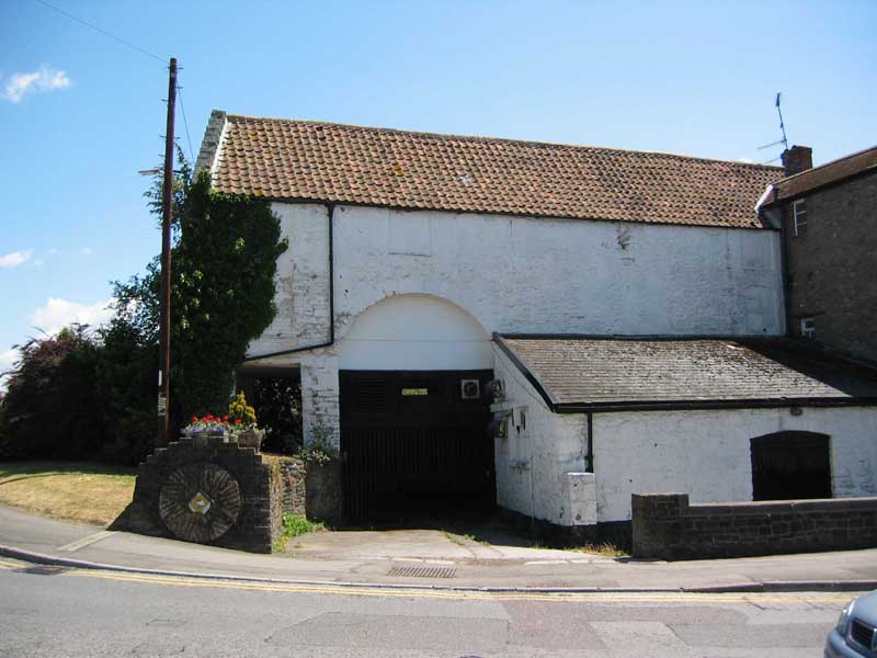
The White Lion pub (now Old Mill) in Portishead High Street |
The archway where passengers walked through from the High Street to the station can be seen at the front of the pub (though now blocked off). See also Then & now and Portishead |
|
|
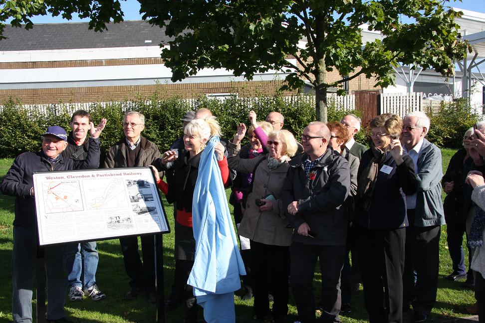
Interpretation Board |
On 23 June 2020, the WC&P Railway Group erected an Interpretation Board on Wyndham Way, opposite the Old Mill pub (formerly White Lion), close to the station site. This board was funded jointly with Portishead in Bloom and Gordano Civic Society and replaced an earlier board erected in 2013. Other boards have now been erected. See Interpretation Boards page for locations. |
|
|
The railway bridge over a rhyne in Portishead |
The remains of the metal bridge covered in undergrowth is on the left of Wyndham Way when approaching Portishead just before the current road bridge over the same rhyne. (A rhyne is a drainage ditch pronounced ‘reen’ - see Wikipedia entry). The old railway bridge can’t be seen from the road. The line actually crossed the rhyne twice in a short distance. The other bridge was roughly where the A369 crosses the rhyne today. See also Portishead bridges |
|
|
Black Rock and Nightingale Quarries sidings |
The loading bay on the WC&P was in the valley below the B3124, and some years ago the ramps were removed and the ground levelled. Photo (taken in 2006) shows traces of stone from the ramps in the field and old quarry workshops behind. Black Rock Quarry is in woods behind. The raised banks of the narrow gauge line to Nightingale Quarry can be traced on the right side of Valley Road going uphill from the B3124, while the narrow gauge line route to Black Rock Quarry can just be made out by following a footpath in woods above Black Rock Cottages, where some old quarry building remains can be found. See Black Rock Quarry. |
|
|
Cadbury Road |
The Site of Cadbury Road halt now on Cadbury Lane, Weston-in-Gordano. Looking towards Clevedon. |
|
|
Weston-in-Gordano |
About half a mile of the actual route can be walked at the Clevedon side of Weston-in-Gordano. Approaching from Portishead, take the lane on the left just before the church. Just past a house, the track bed crosses the lane at right angles. Take the stile on the right and you’re walking on the old track bed route. This is Avon Wildlife Trust land (Weston Moor reserve). The route is clearly marked and is a very pleasant walk. View on right is taken from Weston-in-Gordano looking south-west towards Clevedon. See Cadbury Road |
|
|
|
This view is looking north-eastwards, back towards Weston-in-Gordano. Note the village church on the left, and the proximity of the route of the line to the village. The halt for the village was called Cadbury Road and would have been in the far distance. |
|
|
|
This view is taken about half a mile to the south of Weston-in-Gordano looking south-west towards Clevedon. The ground is slightly raised here which seems almost certain to be exactly on the route of the line, and there is some evidence of hardcore. A further half a mile south west was Walton-in-Gordano halt. There is no footpath access at present across the fields. |
|
|
Walton-in-Gordano |
The site of Walton-in-Gordano halt, which was a few metres beyond the gate. View looking towards Clevedon. The road is Moor Lane. |
|
|
Gordano Valley embankment |
A low embankment can be seen from the Portishead to Clevedon Road between Walton-in-Gordano and Clevedon, on the left going towards Clevedon. |
|
|
Conygar Quarry |
The remains of the narrow gauge line embankment is now hard to see due to being very overgrown. Photo is looking from the railway towards the quarry looking at the end of the embankment. The standard gauge siding ran from the foreground towards the left hand side of the trees. See also Conygar Quarry page. |
|
|
Walton Park |
Walton Park halt was situated opposite the junction with Holly Lane. View looking towards Portishead. The shelter would have been just on the left. |
|
|
Go to Southern section - Colehouse Lane to Weston-Super-Mare ... |
||


These two publications will be very useful when researching or exploring the line. Click on either book to view in the WC&P Railway Group on-line shop.

